A Hydro Case for Regional Cooperation
Balancing future growth ambitions with an ecologically rich river basin in a politically charged region.
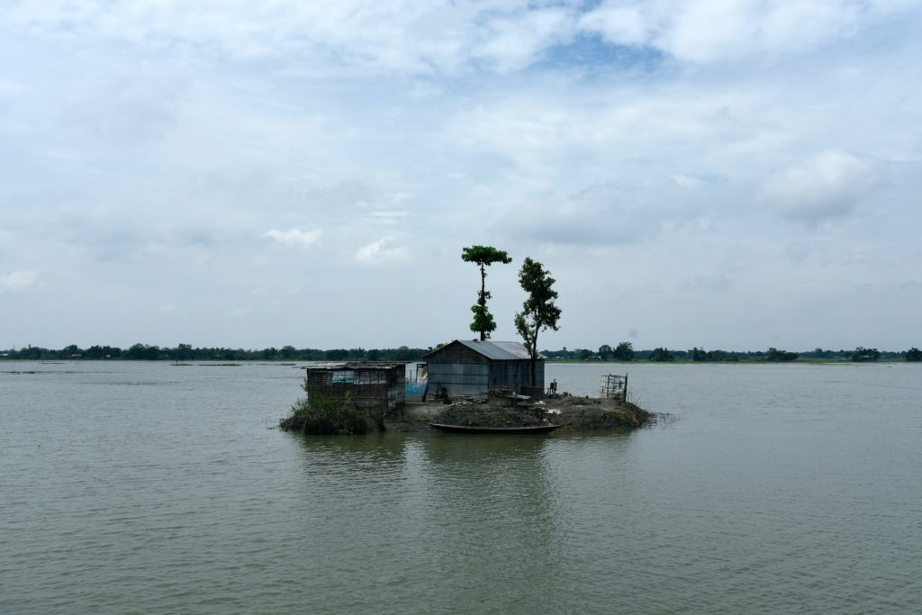
Each year hundreds of people inhabiting the Brahmaputra River basin become silent witnesses to the loss of their homes. Annual flooding erodes swathes of land, the currents carry river islands, home to riverine communities, displacing land with water. There have been 25 major floods in Assam since 1950. With the increasing rate of floods and channel change over the years, traditional flood adaptation practices in riverine communities are becoming prone to failure. Their houses, crops, land use, and use of natural resources are based on traditional ecological knowledge which aids in mitigating the adverse effects of flooding. This knowledge, however, is now being challenged by the increasing unpredictability of the river’s flow.
There is a fundamental flaw in the so-called technocratic purely engineering approach to understanding a river. It strips the river of its living entity and treats it as a pipe of water that can be bent, broken, and joined again. The nature of the Brahmaputra basin is unique – its braided characteristic makes the river prone to frequent channel migration and excessive siltation downstream, causing the river to flood each year and bringing fertility to the land. However, changing and erratic rainfall patterns coupled with artificial building activities have affected the lives and agrarian livelihoods of thousands of people that the Brahmaputra sustains.

Water is now a subject of geostrategic concern for countries across the world. The rhetoric of the third world war being one for water may not be far from reality. Whether it may be a dispute over the Nile Basin, Euphrates-Tigris Basin, or a human-nature conflict as a result of unchecked development – the center of it all is water. As Asian countries gravitate towards achieving carbon neutrality goals, many, including China have redoubled efforts on harnessing hydropower as a driver of growth. Cradled in the Himalayas, the Brahmaputra is a transboundary river flowing downstream of China through Tibet, north-eastern India, and Bangladesh. Forming part of the world’s most densely populated river basin, the Ganga-Brahmaputra-Meghna basin is yet to be studied in its entirety to ensure sustainable livelihoods.

As a lower riparian neighbor, India has repeatedly urged China to ensure that the interests of downstream states are not harmed by activities upstream. With respect to the Brahmaputra River, India signed an agreement with China in 2002, that provides sharing of hydrological data and cooperation in flood management. However, beyond data sharing during the monsoon period, there is no formal treaty between India and China regarding the Brahmaputra waters. Beyond existing activities on the river, China is planning to build the world’s biggest hydroelectric dam over the Yarlung Tsangpo (as the Brahmaputra is known in China) river in Tibet near the Arunachal Pradesh border. The dam which is said to have ‘no parallel in history’ has drawn criticism from human rights groups, environmentalists as well as neighboring countries. For years, the fear of China controlling and diverting the water in its territory has raised concerns for both downstream neighbors, India and Bangladesh. The flash flood of June 2000 in Yigong (a tributary of the Tsangpo) presents a classic example of how a hydroclimatic disaster triggered in the upstream Tibet region affected Arunachal Pradesh and Assam in India the most. Given the susceptibility of the Himalayan region to climate change, the risk of such disasters affecting downstream regions and communities increases multifold, and the absence of a formal treaty on water sharing between the Asian giants adds to geopolitical concerns.
Inclusive hydro-diplomacy, a community approach
Policy-makers in both India and China, continue to defend the dam projects in their respective countries as run-of-river hydroelectricity generation projects. This approach diverts a part of the river to run past the electricity-generating turbines. The waters then flow back to join the river, claiming no loss to the total water flow and quantity. Seemingly harmless, the dam causes two problems downstream:
There have been 25 major floods in Assam since 1950.
Firstly, dams prevent the movement of silt that fertilizes the floodplains of the Ganga-Brahmaputra-Meghna. Water flowing down the young, rocky, and crumbly Himalayas brings food for the fish and fresh soil for the communities downstream. These small rocks, however, are a menace to the turbines because they damage the blades. Further, holding back sediment and silt flowing down results in sand from riverbeds being exposed, leaving behind a sandy infertile desert when the river changes course. A change in the quality of the water due to reduced silt will have long-term effects on agricultural output affecting the food security of the region. Environmentalists have long fought for a part of the river to continue to flow to maintain ‘minimum environmental flow’.
Secondly, passing water through turbines requires the curbing of the pulse of the river. The farmers downstream are dependent on the water pulses to catch fish. Research on two of the world’s largest run-of-river hydropower dams (Jirau and Santo Antônio, Brazil) on the Madeira River document how downstream aquatic organisms and river-dependent populations suffer the slow demise of biodiversity with alteration in frequency, magnitude, duration, timing, and rate of change of natural flow regimes.

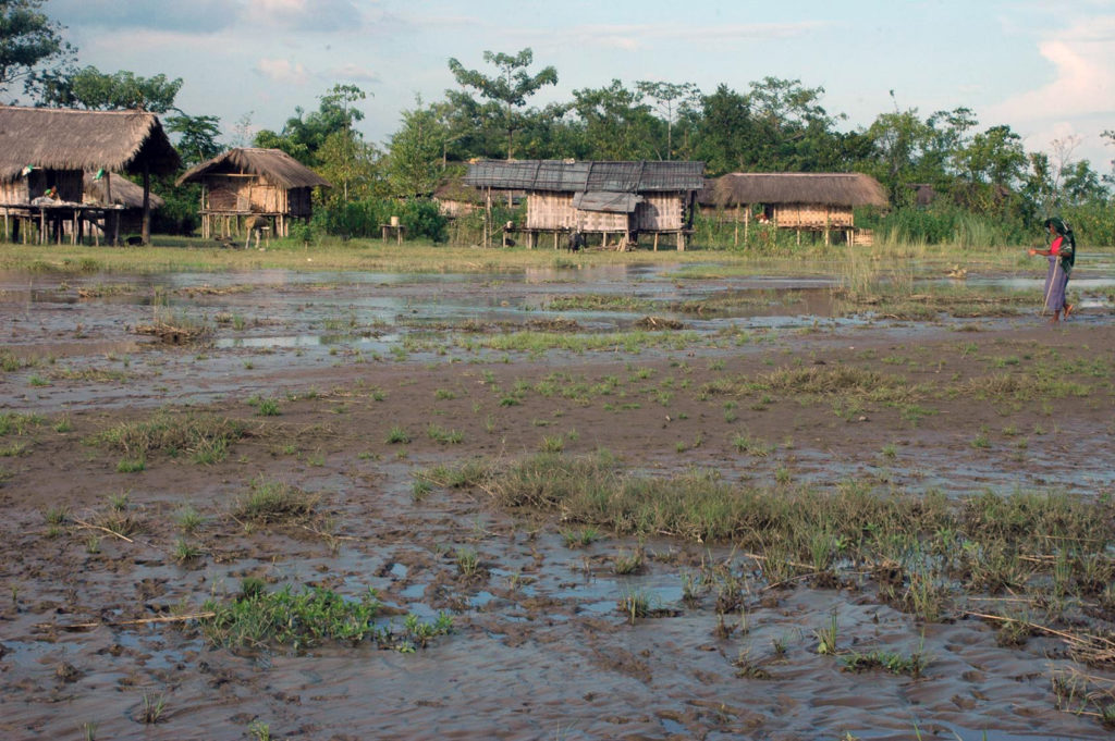
The Brahmaputra River’s precarious state has led to the development of policies and legal frameworks to regulate the river’s use and management within riparian nations. How do we move beyond emotive politics to save the river? Communities that inhabit islands and banks of the Brahmaputra encounter numerous challenges each year – their traditional adaptations along with scientific interventions may be the answer to the river’s survival. A chang ghor, for instance, is a house on stilts that the Mishing tribe from Assam have traditionally built to survive the Brahmaputra floods each year. Within the house, there are other flood adaptations like food and grain storage on bamboo shelves built closer to the ceiling.
From livelihoods that are reliant on agriculture to folk traditions, the centrality of which is water, there is an inherent sense of consciousness in the communities that encounter natural disasters that are integral to their lives. The idea of water diplomacy must be altered to reimagine how the river is viewed in its entirety. River sharing fosters the development of cooperative water management systems, encouraging joint efforts in monitoring, maintaining, and protecting shared rivers and their ecosystems. By emphasizing sustainable practices and ecological preservation, countries can collectively ensure the long-term viability of their shared water resources, reducing the likelihood of conflicts rooted in environmental degradation.
Hydro-political relations and the way forward
Our tryst with the Brahmaputra does not end in India but in Bangladesh. Like China, India has also engaged in hydropower projects in Arunachal Pradesh along the Brahmaputra as a part of larger economic and development goals. Expected to start construction in 2025, the Tawang II dam on the Tawangchu River in Arunachal Pradesh has been proposed as an 800MW hydropower project. Given that India and Bangladesh share 54 transboundary rivers, Bangladesh can and has in the past demanded fair and equitable water sharing and multilateral agreements from India.

One of the significant treaties between India and Bangladesh includes the Ganges Water Sharing Treaty, also known as the Farakka Agreement, signed in 1996. This treaty regulates the distribution of the Ganges River’s water during the dry season, ensuring that both countries receive a fair share of the water.
Another Mahakali Treaty signed in 1996, focuses on the utilization of water resources for irrigation and hydropower generation, while also addressing flood control measures.
India and Bangladesh share 54 transboundary rivers.
The 38th Joint Rivers Commission of India and Bangladesh in 2022 addressed the needs of irrigation downstream, availability of drinking water, and the sharing of waters in the Teesta (a right-bank tributary of the Brahmaputra). As the case in run-of-river project claims of China to India, a succession of 30 proposed, operational and non-operational dams are located on the Teesta in India. Bangladesh’s concerns are similar, from disrupting the flow regime, arresting sediments, and loss of fisheries. India’s way to accede to the fears in Bangladesh is by supplying electricity to Bangladesh from one of the projects.
The overarching threat is that of mass displacement and ecological damage, leading to unpredictable human concerns and security risks. It is at such a junction that a greater synthesis of scientific methods and traditional practices needs to intersect, to build sustainable livelihoods and resilience among local communities. While bureaucracy tows its old pathways of navigating treatise and MoUs, the problem of hydro-diplomacy remains unresolved platforms for dialogue and negotiation, where they can address concerns, share information, and discuss the equitable distribution of water resources. Through such diplomatic channels, countries can build trust, strengthen relationships, and develop frameworks for resolving potential conflicts that may arise from water scarcity or disputes surrounding over-usage in order to encourage shared access to this precious natural resource.
