
Mapping the Way to Water Security in the Trans-Himalayan Peatlands
Peatlands are vital for water security in the Trans-Himalayas, but current knowledge gaps mean protection is impossible.
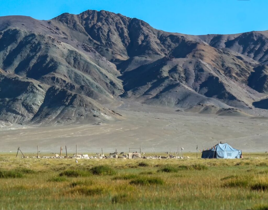
There’s a saying in Ladakhi: “If you have no water, you have no settlement”. For the Ladakhi people, who live in the high-altitude Ladakh region of northern India, part of the Trans-Himalaya, ensuring access to water has always defined their survival. This remote and rugged landscape, spanning northern India, Nepal, Tibet, and Pakistan, is characterised by extreme elevation and harsh environments. Communities like the Ladakhi have long relied on meltwater from snow and glaciers to sustain themselves. Yet today, climate change threatens these vital water sources, turning villages into ghost towns and pushing communities to the brink of crisis.
“If you have no water, you have no settlement”.
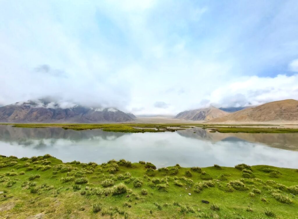
The solution to water resilience might lie in the region’s peatlands and high-altitude meadows – natural water reservoirs that could help combat drought. However, these landscape features are poorly studied and are under threat, and their potential for supporting communities in a changing climate remains largely unknown. Mapping them is a crucial step toward developing a better understanding of their potential and ensuring water resilience for the future.
Melting glaciers threaten water supplies
The Indian Trans-Himalaya covers over 184,000 square kilometres – more than 5% of the country’s landmass – at elevations ranging from 3,000 to 5,000 metres. These heights experience some of the world’s most limited rainfall, with regions like Ladakh receiving only about 100 mm annually – less than a tenth of India’s national average of 1,083 mm. UNESCO refers to this area as the “Cold Desert Cultural Landscape”. Here, snow melt, glaciers, and wet meadows or peatlands provide vital sources of water for over 330,000 inhabitants, supporting agriculture, daily needs, and livelihoods. But as glaciers retreat and snowfall patterns shift due to warming temperatures, these natural water sources diminish, severely impacting access to clean water and endangering the very existence of these high-altitude communities.
Satellite analyses of Ladakh, by the South Asia Institute at Heidelburg University, reveal significant changes between 2000 and 2019: winter and spring snow cover decreased, while summer snow slightly increased – indicating a change in snowfall timing and intensity. These changes disrupt the snowpack accumulation vital for water storage in the Trans-Himalayan region. In addition to changes in the snowfall pattern, long-standing glaciers in the region have been retreating rapidly.
The Chhota Shigri glacier in Himachal Pradesh, a 9-kilometre-long valley glacier that feeds the Chandra River, is the longest continuously monitored glacier in the Himalayas. Its ongoing ice loss reflects reduced snow and ice accumulation during winter months, highlighting the impacts of changing climate patterns. Similarly, long-term studies have documented the retreat of the Baga Shigri glacier, which, according to research published in Physical Geography in 2017, receded approximately 1.1 kilometres between 1965 and 2014 – roughly the length of two football fields.
As these glaciers continue to shrink at an accelerated rate, downstream water flows are projected to peak by mid-century before gradually declining each year. This pattern suggests that regions relying on glacial melt for their water supply will experience severe flooding until 2050, only to be followed by prolonged periods of droughts. The outlook is troubling for both communities and ecosystems that depend on glacial water, facing an uncertain and increasingly challenging future.
While the Indian government is aware of the current situation in the region and is implementing short-term measures to provide water to local communities living in the Trans-Himalayas, greater emphasis should be placed on long-term, nature-based solutions that can effectively store water and improve community resilience.
Nature’s finest water reservoirs
One promising natural solution to the water crisis in the Trans-Himalayan region is the protection and restoration of peatlands and high-altitude wet meadows. Globally these water-logged ecosystems are vital, with peatlands storing around 10% of the world’s freshwater, according to the Natural Conservancy, and acting as essential water buffers. Composed of undecomposed organic matter, peatlands feature large pores that enable them to absorb and retain substantial volumes of water. Many peatlands worldwide, including those in the Himalayas, are characterised by Sphagnum moss, which can hold up to 20 times its dry weight in water. A preliminary study published in January 2025 by GIZ India in collaboration with Wetlands International South Asia and the Indian Ministry of Environment, Forest and Climate Change, estimates that peatlands cover approximately 260,000 hectares in the Indian Himalayas.
Peatlands store around 10% of the world’s freshwater.
Once water is stored in peatlands, it is gradually released into streams, helping to prevent sudden floods and maintain a steady flow throughout the year. During dry periods, peatlands serve as critical water reservoirs, buffering the impacts of droughts and ensuring a more reliable water supply. Research published in the Journal of Hydrology in 2023 on the Andes of South America from a landscape similar to the Trans-Himalaya show that peat-forming bofedales, a type of high-altitude wetland, can provide as much as 98% of the water flowing into rivers and streams during the dry season. This “sponge effect”, absorbing and releasing water, underscores the vital role that peatlands play in providing a natural hydrological buffer and maintaining water availability during dry periods.
In arid, high-altitude regions like the Trans-Himalayas where snowmelt is the primary water source, peatlands function as natural flow regulators. They store winter and spring snowmelt and release it slowly during late spring and summer – crucial times for the survival of villages in the region. As climate change causes earlier snowmelt and reduces overall snowfall, peatlands could help delay water runoff and extend water availability, aiding communities in coping with increasingly brief and unpredictable periods of water supply.
Beyond their water-regulating functions, peatlands play a significant role in carbon storage. According to the Global Peatlands Assessment: The State of the World’s Peatlands by the UN Environment Programme, despite only covering about 3% of Earth´s surface, peatlands store almost a third of the world’s carbon. Peatlands provide critical biodiversity habitat for various species and support local livelihoods through grazing. However, although they are highly significant, peatlands remain understudied and undervalued, research published in the Journal of the Society for Conservation Biology in 2025 demonstrates that only 17% of the world’s peatlands fall under protection.
In India, there’s a significant knowledge gap about the extent and locations of peatlands, with only 1% of India’s peatlands officially mapped. How can we effectively protect and manage ecosystems when we lack fundamental information about their location and extent?
Overcoming the knowledge gap
As part of the Alexander von Humboldt Foundation’s International Climate Protection Fellowship, my research involves demarcating and mapping high-altitude peatlands in the Trans-Himalayas to explore the correlation of peatlands with the water availability. By doing so, I aim to develop a better understanding of the existing synergies between these ecosystems and local water flow. This knowledge can inform conservation strategies, ensuring that peatlands are effectively protected and integrated into water management policies to strengthen climate resilience and support sustainable development in the region.
Currently, only 17% of the world’s peatlands fall under protection.
The mapping process involves examining remote sensing and GIS-based datasets combined with ground truthing – visiting and physically verifying the data. However, because of the geopolitical uncertainty of the region and very limited research in the past, there is significant data unavailability in the region. To address this challenge, the research focuses on gathering community knowledge along with high-tech modelling and satellite datasets to serve the purpose.
In the Trans-Himalayan region, my initial findings indicate that peatlands are widespread particularly in areas where groundwater emerges. Mapping indicates that their distribution is largely influenced by topographic features – such as valley bottoms and gentle slopes – as well as climate. These areas are also essential for controlling the sources of rivers and streams. Protecting these zones would help maintain a steady flow of water, ensuring it remains available for communities and ecosystems.
An additional urgency to protecting peatlands is that when they become degraded or dried, they release large amounts of CO2 – research published in Nature Climate Change in 2021 estimates that drying peatlands could release an additional 860 million tonnes of CO2 into the atmosphere each year – significantly contributing to climate change. Therefore, to achieve broader climate, water, and biodiversity goals it is essential to accurately assess the extent and ecological health of peatlands in areas such as the Trans-Himalayas. This understanding will be key to developing national strategies focused on conserving healthy peatlands and restoring those that are degraded.
Mapping is the fundamental first step to ensure that peatlands are recognised and integrated into India’s broader conservation strategies. By understanding the location and function of peatlands – and their role in regulating snowmelt within the fragile environment of the Trans-Himalayas – we not only move towards protecting an essential ecosystem, but we help safeguard community resilience by protecting the foundation of any mountain settlement: water.


Join Planet
REVOLVE today
We strive to communicate sustainability for a better world for the next generations.
Support us by becoming a member of REVOLVE Planet today.
Become a Member