
Mumbai – India’s financial capital – has always been a city of contradictions. Home to billionaires and beggars, where sky-piercing high-rise towers sprawl over slums, and old growth forests stand at odds with the ever-expanding concrete jungle. Increasing pressures of urbanization in a city already bursting at its seams plus growing demand for housing and infrastructure, is eating into the city’s last remaining green spaces resulting in a Faustian choice for urban planners and residents. With the looming threat of climate change, evermore acute for a coastal city like Mumbai, a delicate balance will need to be struck to ensure that India’s most important economic center continues to grow sustainably, protecting the environment and the quality of life.
Mumbai: Balancing Urbanization and Nature
14 October 2021 | Photography by Hoshner Reporter
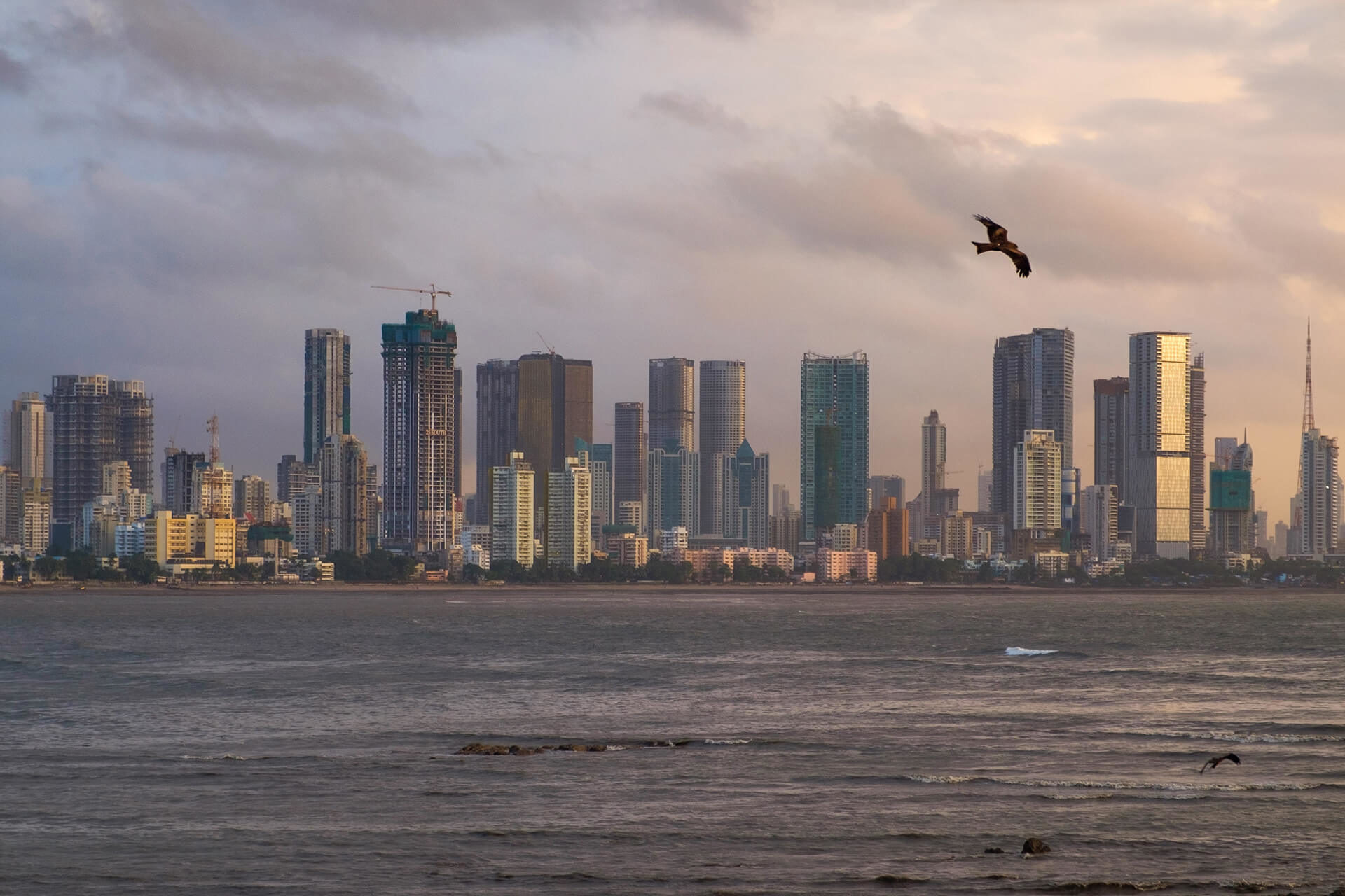
Mumbai is amongst the most densely-populated cities in India with an estimated population of over 20 million residents. Mumbai is also India’s economic engine contributing 6% of India’s GDP and 33% of Income Tax collection, and attracts migrants from all over the country. Flanked by the coast on the east and the west, Mumbai’s space for expansion is limited. This presents a number of challenges, including pressure on land and water resources, road and public transportation networks, and lack of open spaces and affordable housing. With the city undertaking a big infrastructure push including setting up a Metro rail network to supplement the suburban train systems, new arterial roads and bridges on the city’s eastern and western seaboards and a number of east-west connectors to reduce traffic snarls, the pressure on Mumbai’s green cover is only set to increase, especially on its last remaining old growth forests, located towards the north of the city.
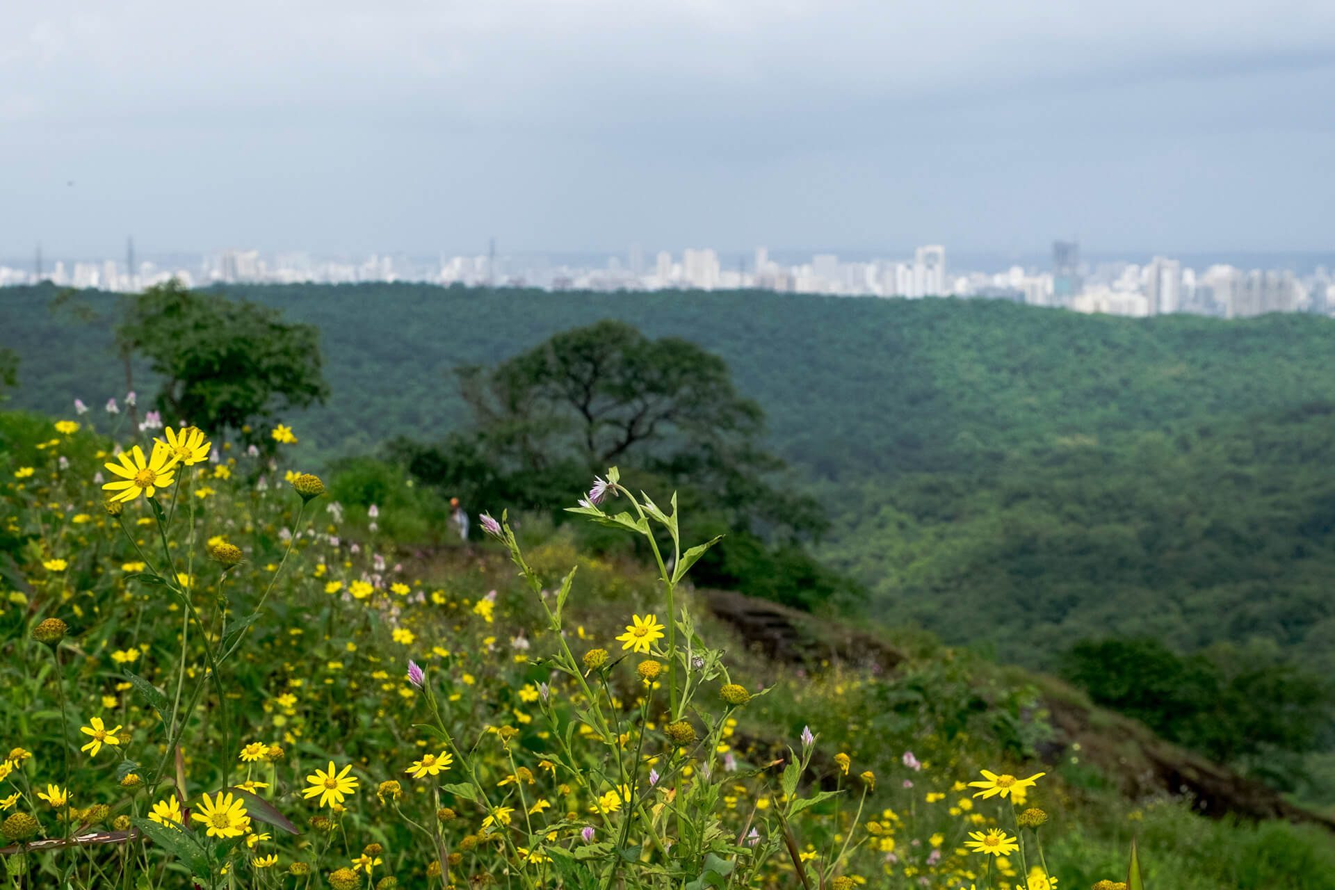
For anyone who has visited Mumbai and experienced its traffic, congestion and frenetic pace, the idea of acres of green space within the city seems unimaginable. Yet in that respect Mumbai has the unique distinction of having a thriving National Forest within its boundaries. The Sanjay Gandhi National Park (SGNP) in North Mumbai is a 103 square kilometer forest hemmed in by Mumbai’s suburbs, which is home not only to hundreds of species of plants, birds and reptiles but also to deer, crocodiles, and a large well-adapted population of leopards. The national park also provides much needed respite to the city’s space starved citizens and is a favored location for walkers, cyclist and even trekkers.
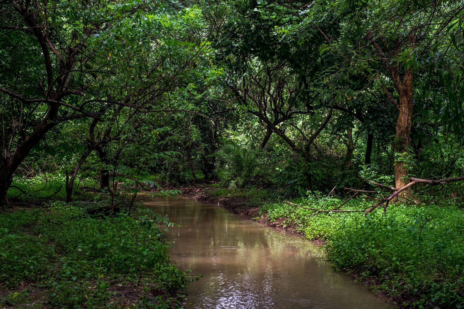
Beyond biodiversity SGNP and the adjoining Aarey Forest serve as massive carbon sinks in over-polluted Mumbai and a bulwark against the flooding that the city faces annually during its monsoon season. SGNP is also part of the catchment area of the lakes that supply some of Mumbai’s water and the source of the Mithi and Dahisar rivers. The ecological services provided by the SGNP to the city therefore are critical for preserving this important green lung. Yet, over the years, the forests have lost land to encroachment, clearings for grazing and agriculture, forest fires as well as diversion of land use. Even today several connectivity projects including elevated roads, tunnels and even train tracks that would go over, under and through the National Park, leading to fears that these will fragment the land, shrink habitats and ultimately endanger the survival of the forest.
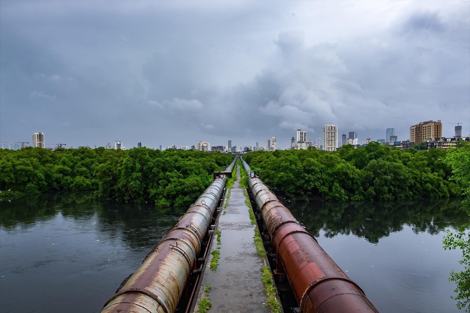
The Mithi River – one of the oldest in the state of Maharashtra – is Mumbai’s natural storm water drainage system. Originating from the overflow of the Vihar and Powai lakes in SGNP, the Mithi snakes through some of Mumbai’s most congested residential and commercial areas before emptying into the Arabian Sea. Despite its pristine origins, years of pollution from discharge of industrial effluents, untreated sewage, organic waste and garbage has made the Mithi a dying river. Encroachments and the building of concrete retention walls within the national park, dumping of debris and reclamation of the river’s floodplains, most notably for the development of the sprawling BKC commercial center has resulted in the river flooding during the monsoon. The flooding, which has increased in frequency and severity in recent years, not only paralyzes road and rail networks in the city but also endangers the lives and property of those who live along its banks.
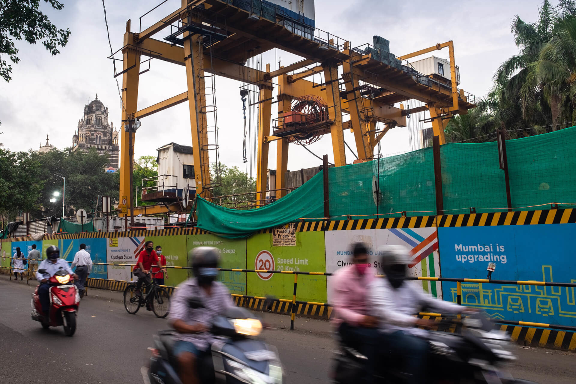
“Mumbai is upgrading”, say the metal barriers that line the construction sites of the Metro III line which will connect the city’s south to the commercial districts of BKC and SEEPZ and both airport terminals before terminating in Aarey Forest. The Metro III is one of 14 Metro lines, which is one of the most complex and ambitious projects to be built in Mumbai. It is an important connector which will take the load off the overstretched suburban train network, cut travel time and offer an alternative to those who take their cars to work. It is also the most controversial, due to the proposed location of its train depot also known as the Metro car shed in Aarey forest, for which close to 2300 trees were to be cut.
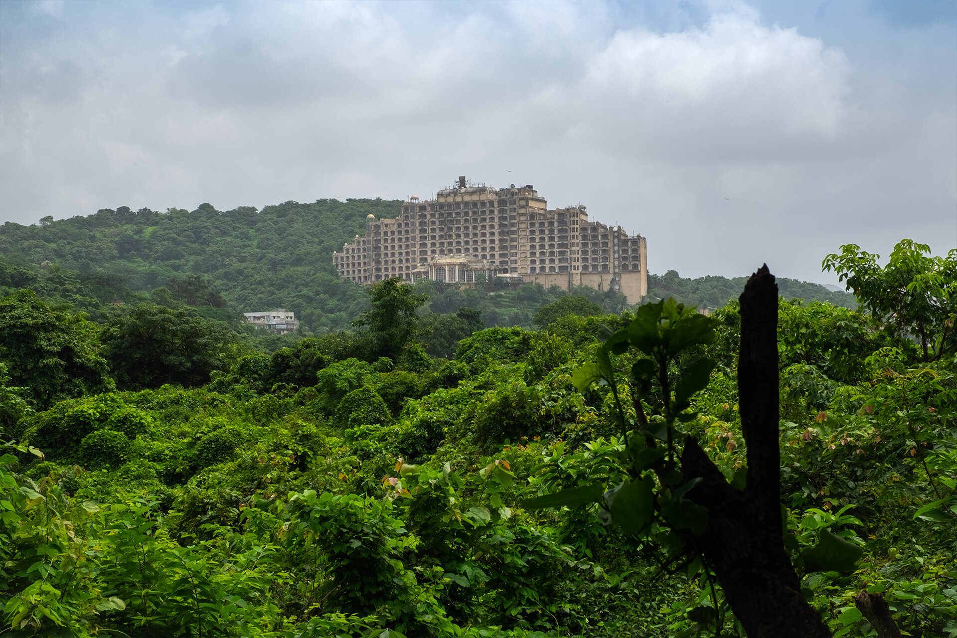
Spread over 3,000 acres, Aarey forest, also known as the Aarey Milk Colony, is in the eco sensitive zone of SGNP and acts as a buffer between the national park and the city. It is known to be biodiverse with rich flora and fauna including a small but highly-visible population of leopards. It was however not technically a notified forest but part of the Aarey Dairy Development. Due to this technicality, much of the land from the forest has, over the years, been diverted for various purposes, including agriculture, a film studio, a now defunct resort (pictured above), a commando training center and ironically even a proposed zoo.
The trees to be cut for the car shed in Aarey were in addition to the over 3,500 trees which were already marked for cutting or transplanting for stations and other infrastructure along the route. Environmentalist fought in court against the move to have the depot in a forest, alleging that there were alternate sites which were not considered despite being suitable. The Mumbai Metro Rail Corporation (MMRCL), the state agency tasked with executing the Metro Line III argued that the carbon sequestration capability of the metro, due to reduced cars, would far outstrip the carbon sequestration benefit of the trees cut over its lifetime and so the depot at Aarey should be allowed. Whilst the construction and tree felling for the depot was initially stayed, the courts eventually threw out the petitions, post which the MMRCL in an act of uncharacteristic alacrity cleared majority of trees at the metro car shed overnight. Just over a month later, a shift in political winds brought a new government to power in the state which has vowed to shift the car shed out of Aarey. The trees though have already been cut and the question of the new location for the depot remains unresolved and mired in controversy.
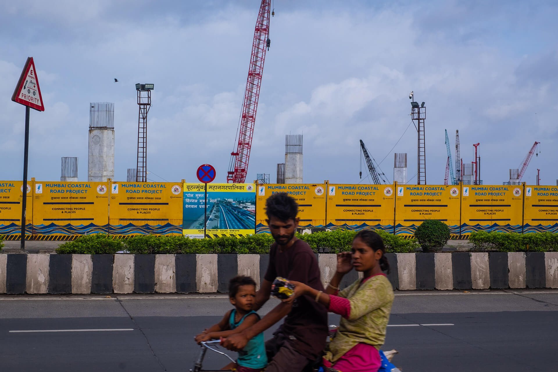
Besides the Metro, the other mega infrastructure project currently underway in Mumbai is the coastal road. Hugging the western seafront, the 22 km coastal road, when completed will connect Mumbai’s southern district to the northern suburb of Kandivali, in effect offering a parallel road to the clogged Western Expressway. This toll free road is expected to ferry 68,000 cars per day one way and reduce travel time from 2 hours to 40 minutes. The addition of roads will be a relief to commuters in a city where vehicular density is more than 430 per kilometer of road. The project however has been criticized on account of the massive cost outlay which will largely benefit a minority of Mumbai’s car owning population; over 75% of commuter trips in Mumbai are currently on the suburban rail and BEST bus network. While a whopping INR 1,300 crore (150,000 Euros) will be spent per kilometer of costal road built in the south section, mass transport systems like the BEST continue to languish for lack of investment, although they carry far more people, are far less polluting per capita, and are critical for last mile connectivity in Mumbai.
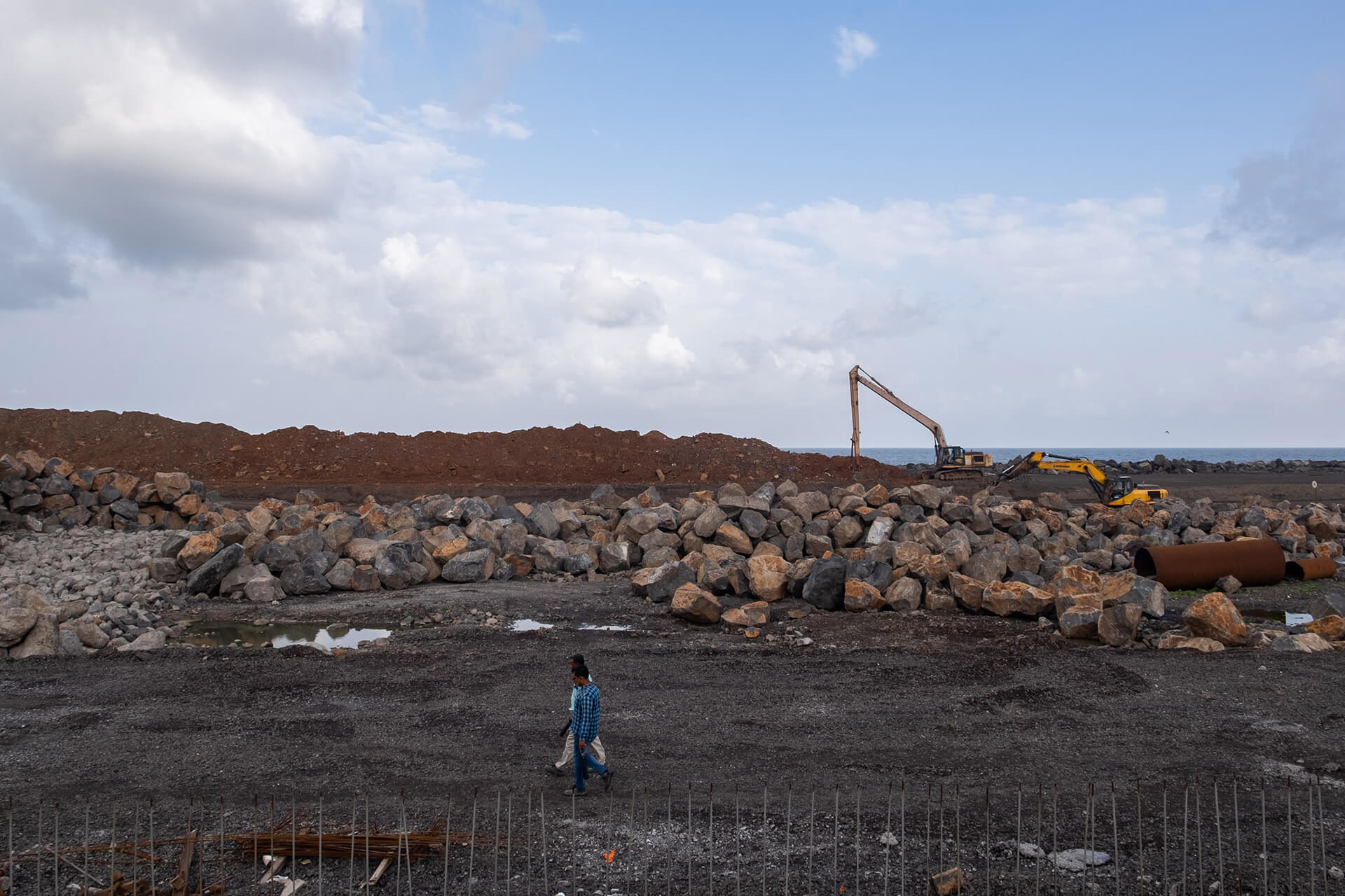
While the coastal road was initially planned to be built on stilts, due to cost considerations, the southern section is now planned as a road which will be built by reclaiming land. Just the southern segment will require 111 hectares to be landfilled and reclaimed from the Arabian Sea for the road and other amenities. Activists have argued that this amount of reclamation will erode Mumbai’s few remaining beaches, impact marine life and affect the livelihoods of local fishing communities who operate close to the coast. There is also the likelihood of the coastal road exacerbating the issue of flooding in a city where the number of days of extreme rainfall in a season has increased, the carrying capacity of the Mithi has reduced and the prospect of sea level rise is already a significant risk factor.
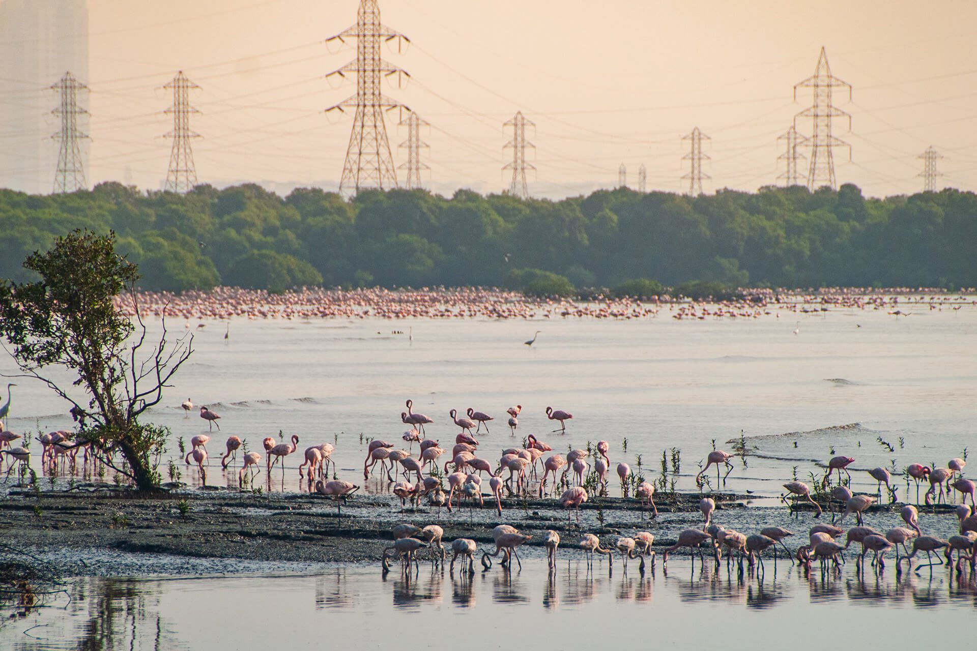
In 2005, the Bombay High Court passed a landmark judgement declaring Mangroves as protected forest and directing state agencies sitting on mangrove land to transfer the same to the forest department. While progress was initially slow, in the last six years the state has taken over more than14,000 hectares of mangroves. This is not a moment too soon for Mumbai, where mangrove cover, despite being amongst the largest in the country, has shrunk drastically over the last two decades. The city is set to lose mangroves to the Mumbai-Ahmedabad bullet train, the coastal road and other projects. In Sewri, the Mumbai Trans labour link (MTHL) which will connect Mumbai with its sister city Navi Mumbai and the new Airport, will cut through a mudflat area (pictured above), which is estimated to be home to 12-15% of South Asia’s population of lesser flamingos, and in the process destroy over 38 hectares of mangroves. Protection of the remaining mangroves is critical, as the over 3,800 hectares of mangrove forests in Mumbai’s suburbs play a key role in flood control and as a carbon store and will serve as the city’s first line of defense in the battle against climate change.
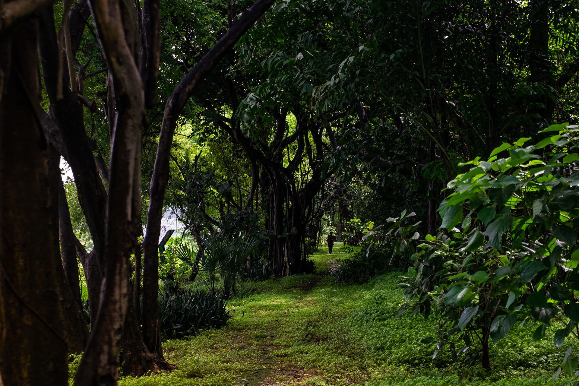
While there are concerns over the loss of flamingo habitat due to the construction of the MTHL, in a rare upside the government notified a 1,690 hectare Flamingo Sanctuary on the Thane creek including 896 hectares of mangroves to compensate for the loss of mangrove forests in Sewri. It is the largest protected natural space in Mumbai after the SGNP and the first such sanctuary for Mumbai’s migratory flamingos. In another instance where environmental groups were able to work with authorities to achieve positive outcomes, the government, nudged by the citizen-backed Save Aarey protests against the Metro depot construction, declared 800 acres of Aarey as a reserved forest. A move that has been long demanded this will offer more robust protection to Aarey forest. Another remarkable success story is that of the Maharashtra Nature Park (pictured above) a 37-acre mini-forest in the congested Sion Dharavi area that was painstakingly created on an erstwhile garbage dump over 10 years and is now a thriving ecosystem with thousands of trees, a lake and mangroves. More such efforts at balance and mitigation will be required in these times where there is a sense Mumbai is at its tipping point, and the way planners respond in the next decade or so will decide the future of the city.

